![]()
|
|

|
Brochures
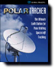
PolarTracker (PDF - 700 Kb.) - Global Imaging's PolarTracker earth station is a fully integrated satellite tracking, acquisition, and processing system for the reception of data from polar orbiting environmental spacecraft including NOAA TIROS, SeaStar ocean color, and military DMSP satellites.

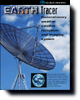
EarthTracer (PDF - 656 Kb.) - Global Imaging's EarthTracer is a fully integrated, direct readout ground station for the reception and processing of data from geostationary spacecraft including NOAA GOES I - M satellites, European Meteosat, and Japanese GMS.
Application Notes
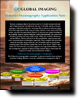
Fisheries Application Note (PDF - 560 Kb.) - Global Imaging provides the fisheries community with remote sensing technology which can be utilized to better manage our renewable marine resources. The Fisheries Application Note discusses these resources and how the Global Imaging solution aids in their management.
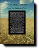
Land Use Application Note (PDF - 544 Kb.) - Recent advances in satellite remote sensing, coupled with fine resolution Digital ElevationÊModels (DEMs) and Geographical Information Systems (GISes), now make the use of remotely sensed satellite data extremely beneficial in a wide range of terrestrial applications. Learn how the Global Imaging solution applies to these advances.

Please contact Michael Guberek for more information on Global Imaging's Products.


201 Lomas Santa Fe Drive, Suite 380
Solana Beach, CA 92075
(858) 481-5750
(858) 481-5794 (Fax)
E-mail mguberek@globalimaging.com
|
|