![]()
|
|
|
|
Small Satellite Ground & Data Systems.
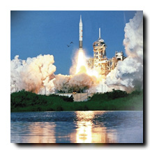
The Ultimate for Earth Orbiting Mission Support.

Managing the spacecraft in orbit, collecting, processing and distributing the mission data to fellow scientists, analyzing the data and reporting the results of your studies---these are daunting tasks. Global Imaging is here to help you succeed. Since 1983, Global Imaging has supplied ground and data systems (GDS) for telemetry acquisition, processing, and archiving of raw and processed data to a prestigious group of national and international clients.
We've now greatly expanded our services to help scientists planning SmallSat missions for the Earth System Science Pathfinder, UNEX, and MIDEX projects. Global Imaging now offers a complete line of GDS products and services including satellite tracking, acquisition, tasking, planning and scheduling, spacecraft commanding, telemetry, data processing, data distribution, and data archival.

The following diagram illustrates the interactions between the components of the Small Satellite Ground and Data System. Please refer to this diagram as you explore Global Imaging's solution for Ground and Data Systems.
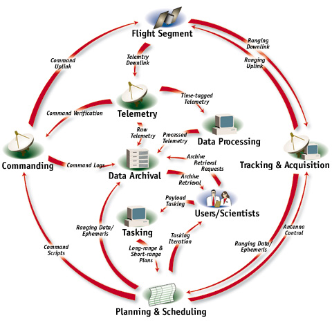
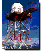
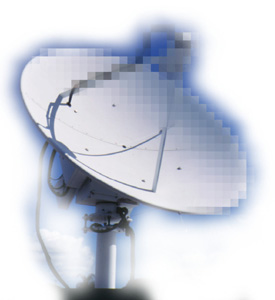
Tracking services include measuring antenna angles, satellite range, and range rate, and computing from these measurements orbital elements sets for use in antenna pointing and mission planning.
Acquisition services ensure that the space-ground link is maintained for the duration of the contact period. These functions include powering space and ground assets, performing uplink radio frequency sweeps to initiate RF lock, monitoring and maintaining link quality, monitoring the short-term and long-term performance of station components, and performing periodic calibration of station components.
Tasking services comprise evaluating requests for use of the space and ground assets. For example, for the collection of data from a spaceborne imager, tasking typically involves creating an image acquisition plan based on requests submitted by a variety of users. Timely communication with other scientists is important in order to maintain a good relationship between the Operations Center and the user community.
Planning and Scheduling Services consist of generating a series of progressively more detailed spacecraft activity plans. The activity plans will depend on the science experiment plan, spacecraft constraints, orbital conditions, and the availability of coordinated ground observation assets for in situ measurements. As the plan execution time draws closer, fine details such as the exact time of orbit-related events including target and station visibility times will be incorporated into a contact plan.
Commanding Services cover all aspects of command formation, command management, command release, and uplink. In typical command formation implementations, structure, content, and rule-based considerations are automated by a software system. This information is conveyed to mission operations in a Command Allocation Document or similar Interface Control Document describing how the onboard processor expects to receive all command information.
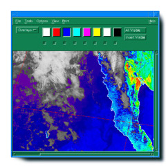
Telemetry Services cover all aspects of spacecraft downlink reception, and include demodulating the encoded information from the carrier with a bit synchronizer, assembling the decoded bits into frames with a frame synchronizer, displaying, monitoring, and analyzing the telemetry in real-time, distributing data to the users, and creating an archival copy of the received data.
Data Processing includes any specialized telemetry services applied at the ground station after the receipt of the telemetry for the benefit of the operators or science users. Common examples include Level 0 processing, which entails the formation of files containing correctly time-ordered telemetry frames with redundant frames removed and missing frames identified; the sorting of Level 0 processed telemetry by onboard instrument source; and finally the application of engineering or geophysical algorithms to the Level 0 data to create higher order data sets.
Data Distribution refers to the distribution of raw and processed data to users. Data Distribution may require dedicated leased lines; the Internet may also be used for file transfer.
Data Archival refers to the storage of the original telemetry records for purposes of safekeeping or for reconstituting data sets at the request of users.
Communication Services refer to the movement of data and status and control information between the Spacecraft Control Center, remote terminals used for space-ground communications, and the user community.
The Ground Architecture for a particular mission depends on mission requirements. For example, an earth-orbiting mission to study X-ray burst events in the cosmos may be placed in a slightly inclined orbit to increase the probability of observing burst events. However, it may not be economically feasible to staff multiple ground stations with skilled personnel to the extent required to maximize the data returned by the mission.
In this case, one solution would be to create a single Spacecraft Operations Control Center at the Principal Investigator's home university with remotely controlled additional ground stations deployed at low latitude sites. The Spacecraft Operations Control Center would use leased dedicated low-rate communication lines to configure and control acquisition and to receive acquisition, tracking, and satellite state-of-health status information.
Higher-volume science data could be recorded automatically at the station and mailed daily or weekly for later reduction by the science team. In this example, the command and telemetry services would be split between the remote RF sites that would perform demodulation and data ingestion and the Spacecraft Operations Control Center that would perform the remaining functions.
Whenever possible we will provide COTS hardware and software. COTS solutions are less expensive, easier to maintain, and more reliable than non-COTS alternatives.
When remote deployments are required for increased data coverage, we can provide ground stations that operate by remote control. Remote control reduces labor cost, simplifies testing, and increases reliability through the coordination of resources at a central site.
We can provide a complete "turnkey" solution or assist you with the parts of the GDS that you don't want to undertake. No matter what you decide, we'll provide you with a system that is reliable and easily operated by non-specialists.
Please contact Michael Guberek for more information on Global Imaging's GDS for Earth orbiting mission support.


201 Lomas Santa Fe Drive, Suite 380
Solana Beach, CA 92075
(858) 481-5750
(858) 481-5794 (Fax)
E-mail mguberek@globalimaging.com
|
|